April 9, 2013
Statistics
Colby, KS 8:10 AM 4/9/2013
Joplin, MO 10:30 PM 4/9/2013
Summary
Cold front play in central Kansas, targeting southern end of front near Wichita. Awoke to temps well below freezing in Colby, KS with vehicles iced over. Crossed front near Salina into temps in the 70’s. Waited for initiation south of Wichita. Pursued linear clusters of storms northeast of Wichita toward Emporia, before calling it a chase and heading to Joplin, MO to position for next day’s chase.
Crew and Equipment
Chase partners: Jennifer Brindley Ubl, Sean Casey, Jennifer Casey, Adam Lucio, Jonathan Williamson, Alec Scholten. Equipment: Canon 60D, Canon t2i, Canon EFS 10-22, Canon EF 50mm, Sony HDR-xr500v.
Video
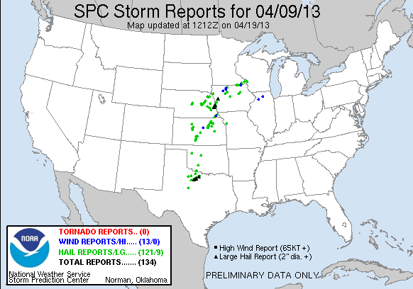
Map
Details
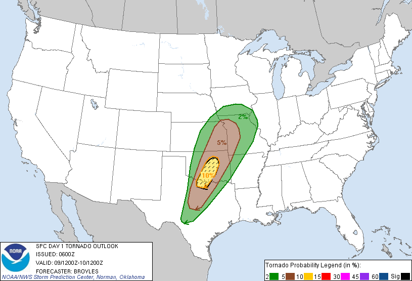
Tuesday, April 9, looked like it was going to be the biggest day of the trip, at least until it became apparent that the models had gotten the surface features wrong. A moist warm sector from Iowa to the southwest was forecast to be overtaken by a deep, strongly sheared trough. A severe weather outbreak looked possible with storms erupting on a cold front/dryline draped from Iowa through central Kansas down into Texas. However, when the event finally arrived, the cold front had come surging through much earlier and stronger than forecast, kicking up cloud cover and post frontal crapvection, while the warm sector remained capped. The real tornado play looked like it was going to be forced well south down the dryline toward the OK/TX border.
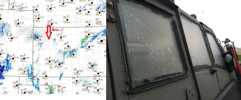
Jennifer Brindley Ubl and I were spending our second day chasing with Sean Casey and the TIV crew. We had spent the night in Colby, KS where we had ended the previous day’s chase. The cold front had moved through overnight bringing in frigid arctic air. We awoke to temps in the lower 20’s with freezing mist. I wasn’t prepared for the return of winter and had packed no winter clothes, anticipating that we’d be in the balmy warm sector for most of the chase trip. I loaded the van and found it encased with ice. Two of the doors I couldn’t get open at all. I had no ice scraper. I did my best with a plastic lid I found in the van in a skimpy t-shirt, the wind howling out of the north at 40 mph. Surface observations and the TIV encased in ice:
Before 9am we were loaded and ready to roll for our target on the southern end of the cold front near Wichita. The caravan was heading east down I-70 with the TIV in the lead, but we didn’t make it far. Sean Casey was driving the TIV solo with Adam and Brandon in the follow vehicles to spare them the discomfort of riding in a vehicle with no heat. Sean radioed to us that the oil pressure light was on. We stopped on the side of the highway briefly to check things out before rolling into a truck stop near Oakley, KS to see if we could get repairs. Sean and Brandon checked the TIV out and after a while concluded that it was probably just a false indicator. We got back on 70 and the indicator light turned off and the pressure read normal as we started to head into warmer air near the front.
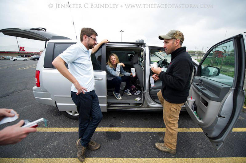
Rounding Salina and turning south for Wichita, we crossed the cold front. The temperature shift was dramatic. Minutes earlier we were fighting to keep the ice off the windshields, staring through little gaps in the ice so we could see the road, but crossing the front it was like we were suddenly in the tropics with temps in the 70’s and dewpoints in the 60’s. We welcomed the warm air, but the cold cover didn’t bode well for our chase with multiple gust fronts fanning out from the cold front into the warm sector which would spell trouble for initiating surface based storms on the front later. We headed down to Wichita and picked a spot south of the city to wait for storm initiation, grabbing lunch, and then spending the next couple of hours in a strip mall parking lot playing the waiting game.
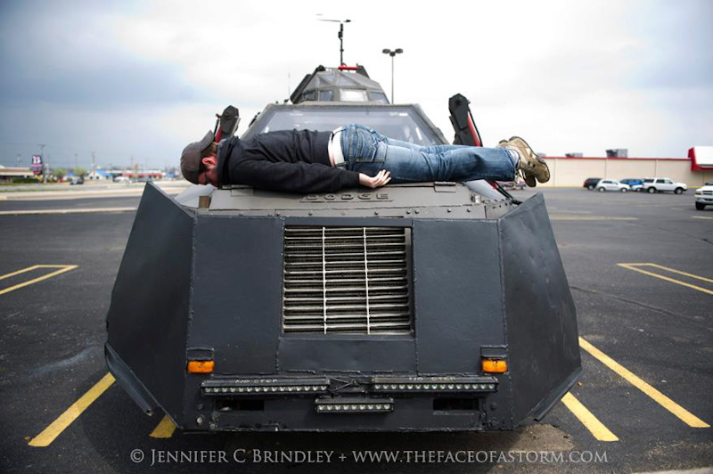
Time passed and conditions across the cold front were looking less and less favorable. SPC started dropping the tornado probabilities from 10 hatched down to 5 in southern Oklahoma. Instability and shear combinations looked about even down the length of the front so we decided to hold our ground and catch something initiating nearby, instead of making the long haul toward the Red River. Boredom started to get the best of us as Jon planked across the hood of the TIV:
Mediocre looking cells were starting to form to our southwest and we decided that this was probably going to be the play. Brandon couldn’t join us for the rest of the chase so we drove to north end of town and dropped him off at his house before continuing northeast out of Wichita toward a couple of prefrontal cells that we hoped would organize into supercells. With Adam driving the TIV and Sean manning the camera, I took over the lead of the caravan using my chase setup and data to navigate us and provide data for the rest of the chase. We plotted a course from El Dorado toward Emporia through the Flint Hills, hoping to get ahead of the lead cell there, which was severe warned. To our west we could see a roll cloud starting to form between the cluster of cells, an unwelcome sight and a sign that we were chasing elevated, linear junk.
We made it to Emporia and were having trouble keeping gaining ground on the storms that were moving northeast at 45 mph. It was also becoming apparent that the cells were weakening as they headed into less favorable air the further north they went. We decided to call it a chase and break off the chase and make for the next day’s target, which was going to be somewhere on the Mississippi river valley. Heading east out of Emporia, I realized looking at my tripometer and having seen my chase mileage before the trip that I was coming up on my 100,000th career chase mile. Otherwise one of the most boring chase photos I’ve taken, I snapped a shot of the mile marker with my cell phone to commemorate the milestone.

Forecasting for the next chase
Joplin, MO
11:02 PM
The next day’s target looked like it could be anywhere from central IL down toward Arkansas. We headed south out of Kansas City and decided to spend the night in Joplin, where we could split the difference between the targets with an easy east option on I-44. We grabbed some dinner at the Cheddar’s and then gathered around outside the hotel that night to discuss the forecast for tomorrow.
Conclusion
What was originally forecast to be the biggest chase day of the trip turned into a spectacular bust. Potentially strong tornadoes were forecast near the dryline/cold front intersection, but the cap won and the cells that did manage to go up there later in the evening were quickly snuffed out. No tornadoes were reported for the day, and we were glad we didn’t make the long haul south, opting instead for the cold front in Kansas, which also busted with only some junky, elevated storm clusters. It was still a fun day out with friends and an adventure chasing with the TIV again. Starting the day in frigid arctic and ice and ending it under balmy, tropical like night skies was a surreal experience. We were also half way to our next day’s chase target, so the day wasn’t a complete loss.
Lessons Learned
- The forecast models can get something as basic as frontal positioning and strength grossly wrong even less than a day out.
- An unexpected, surging cold front can ruin a great chase setup.