Statistics:
| Initial Target: | Litchfield, IL |
| Departure: | Westchester, IL 9:15 am |
| Arrival: | Westchester, IL 2:15 am May 14 |
| Intercepts: | Baring, MO 6:30 pm |
| Tornadoes: | 1 |
| Hail: | Non-Severe (Half inch estimated) |
| Wind: | Non-Severe (not measured) |
| Features: | Tornado, Wall Cloud |
| Miles: | 885 |
Summary:
| Cold front setup with possible outflow/warm front play further south. Chased with Ben Leitschuh. Initially targeted Litchfield, IL for the southern play, but only unimpressive MCV moved through. Crossed into Missouri and blasted north after developing cold front storms. Intercepted tornado warned cell just west of Baring, MO noting developing wall cloud and rotating rain curtains. Brief rope tornado developed. Raced east to keep ahead of the approaching circulation. Finally dropped south of rain wrapping circulation and called it a chase. Celebrated in Quincy with steak dinner at The Abbey. |
Crew and Equipment:
| Chase team included Ben Leitschuh. Equipment: Kenwood TH-F6A Tribander, Dell Inspiron Laptop. Kyocera data card and router, Holux 236 GPS, Robotic camera dome with Sony XR-520V. |
Details:
| A low amplitude trough was forecast to move through the upper Midwest along with a cold front that would initiate thunderstorms by afternoon. The warm sector, however, was forecast to be highly unstable with good low level directional shear. I had hoped that the forecasted morning mesoscale convective system (MCS) would lay down an outflow boundary for warm sector initiation instead of chasing further north where storms would be potentially undercut by the cold front. My initial target was Litchfield, IL. |
 |
| This chase would be the first field test of a project I had been working on for the past several months: a robotic camera housed under an acrylic dome with weather instrumentation (I'm still working on a snappy name for it). The dome is mounted to the roof rails with aluminum square tubing cross supports. Another aluminum square tube mast supports the wind speed and direction and sensors. The wiring runs in through the sliding door. |
 |
| Inside of the acrylic dome, two servo motors give the video camera mounted on top (not pictured) 360 degrees of pan and 90 degrees of tilt. A control box inside of the van allows me to manually control the pan and tilt angle or allow some custom software that I have written to do this for me automatically. |
 |
| Ben Leitschuh and I decided to team up for this
chase. We successfully got the dome mounted in the rain and were on
the road by 9:15 am, heading for Litchfield on I-55. There was some
nice clearing on the satellite over Missouri and we had hoped this move into
Illinois. However, after watching it for awhile it became apparent
that the clouds over IL were back building and the area would remain largely
sun free, which would limit the instability needed for thunderstorm
development. A mesoscale convective vortex (MCV) was tracking through
southern Missouri during the morning hours. This area of low pressure
created by a cluster of thunderstorms was outlined to be the focus in
afternoon development as it tracked across St. Louis into western Illinois.
Once in Litchfield, Ben and I briefly considered chasing this target, but
the storms in the complex appeared very disorganized and we found it hard to
believe that discrete supercells would develop within. A tornado watch
to our north over northern Missouri and southern Iowa for storms developing
along the cold front convinced us that this would probably be the best play.
We loathed heading into Missouri due to its reputation for bad terrain and
roads, but we didn't want to miss the best storms. We crossed into Missouri on I-270 north of St. Louis. While in the far left lane of the four lane interstate, traffic came to a sudden stop. A vehicle had pulled half way off the road and there was something laying in the road behind it. At first I thought it was a bag that was flapping in the wind, but soon realized it was animal flailing on its side. I told Ben it looked like a pig, but that seemed completely ridiculous so he suggested it was a cat. A distraught woman ran out of the pulled over vehicle down the shoulder and scooped up the animal. It was indeed a baby pig. I'm not sure how he got in the road, if he was the woman's pig, or if he was alright, but it sure was a strange sight to see. A line of storms started to fire in north central Missouri. These were our storms. We plotted a course up highway 61 to 136 west so we'd be downstream from the storms and not playing catch up. On highway 136 a middle storm in the line went tornado warned. The chase was on! We blasted towards Memphis, MO for the intercept. Dropping south from Memphis, we had to cut across the tornado warning and beat the storm's core or risk getting hit by severe hail or worse, emerging out the other side into a tornado. We had to speed quite a bit to pull off this maneuver. Unfortunately, we came up on the back of a county sheriff. The sheriff, probably spotting for the community, was going under the speed limit. Now positioned in the middle of the tornado warning, getting south and out of the path of the storm became a safety issue. We passed the sheriff. I wasn't sure how he would react so I waved as we passed, and he looked startled seeing us coming up on the left. He didn't pull us over, but if he had we probably would have kept going until we were at least out of harm's way from the storm. |
|
| With Ben driving, we beat the storm just clipping the outer edges of the core and taking a few half inch hail stones. We turned west on county road 11 near Baring where the storm's base came into view. To the left there was a large bowing shelf cloud with lots of precipitation behind it. It looked like an occluded base that was done producing tornadoes. On the right was the main precipitation core and forward flanking downdraft. In the middle, however, there was clearing and signs of new development as scud was rapidly rising into the base. |
 |
| We were positioned just right on the storm. Backlighting behind the storm allowed for great contrast. Being positioned right in the inflow notch of the storm is a dangerous place as the storm is moving directly at us. Chasers to the south in a safer position had their view obstructed by the rain pictured on the left side here. Inflow winds from this position were out of the northeast, and we could see bands of rain from the storm's forward flank feeding into the developing wall cloud. |
 |
| Reports were starting to come in that a damaging tornado had hit Kirksville minutes earlier. Looking west as the ground hugging storm approaches: |
 |
| The wall cloud was now fully developed and exhibiting some rotation. It looked like it was getting ready to produce another tornado. |
 |
| Rain shafts started to swirl around underneath the wall cloud. The motion was indicative of a tornadic circulation, but we couldn't confirm a tornado without a debris cloud or condensation funnel. |
 |
| A tail cloud starts to develop on the right side of the wall cloud, as the rotation in the rain shafts underneath tightens up. |
 |
| Suddenly, a rope funnel spins up under the wall cloud. At 6:30 pm we confirmed a tornado! |
 |
| The funnel dissipated as quickly as it came and flared up a couple more times. It seemed like a smaller vortex inside of a larger circulation: a weak multivortex tornado. Ben shot HD footage of the tornado, while I paused from my camera to report the tornado to the National Weather Service. |
 |
| A close up of the tornado. The National Weather Service did a damage survey of this tornado. It formed near Kenwood,, MO, was on the ground for 9.5 miles, and was rated EF0 meaning it did minimal damage. |
 |
| The wall cloud continued to bulk up in size as it ingested rain cooled air from the storm's forward flank. As described by other chasers that were present, it looked like an alligator's mouth. The tail cloud on the right forming the lower jaw with the ragged edges of the storm forming the teeth. It was a dramatic and menacing sight. The tornadic circulation was still on the ground at this point even though it couldn't be seen, and it was moving rapidly towards us. It was time to go! |
 |
| We blasted east down highway 11. Ben was worried that we were going to get munched by the storm so we started going south on the next paved option we came to. Fellow chaser Brandon Sullivan came up from behind us. We didn't have time to talk though. I made a split decision that if we continued going south we would permanently lose the chance to chase the storm, as the large rear flanking core south of the tornado would cut us off from intercepting or spotting the tornado. I decided that we could stay ahead of the storm if we got back up to highway 11 in time. However, the road didn't just turn east at 11, but went north past it in a little half loop. Deciding to turn south had cost us precious moments and the storm was now right on our heels. We blasted north, barreling towards the storm's core with the tornadic circulation off to our left. The little loop we had to drive around to get to our east road took us into the core of the storm. We were slammed by high winds and heavy rains. Ben was quite worried about us getting rolled by the tornado, but I assured him we were still ahead of the circulation and were only experiencing the straight line winds in the forward flanking part of the supercell. We made it to the east road and were able to get out from under the storm back into clear air with the wall cloud right on our heels. | |
| A few miles ahead of the storm we were able to stop and shoot some pictures. While racing east there were reports coming in of a large tornado, but we were unable to spot it with our backs to it. I had the camera in the dome pointing behind us, but I wouldn't learn until after the chase that the footage was lost due to a camera glitch. The storm had now wrapped precipitation around the circulation with the rear and forward flanks converging as the supercell transitioned into a high precipitation mode. |
 |
| With visibility rapidly deminishing in the rain wrapping supercell, we decided it was time to drop south and get out of the storm's path as we would no longer be able to spot any features within it anyway. We turned south at Williamstown but paused for a few more pictures first. There was a lowering on the north end of the base, but we were unable to determine if it was tornadic. |
 |
| We continued south passing close to the core of the storm. The transition between the core and the clear air was amazing. On the right side there was a total deluge of wind, rain, and hail, and on the left side nothing. I had never seen such a dramatic, well defined downdraft. |
 |
| Finally clearing the beastly HP supercell, we paused for one last look at it. The storm was still tornado warned, but the circulation was embedded deep within the core. The only thing visible from our perspective was a dramatic gust front. The storm would continue on crossing into IL, but with darkness setting in and the lack of river crossings, the chase was over. We left the storm quite satisfied with the chase. |
 |
| Ben and I stopped for a celebratory steak dinner (chaser tradition after bagging a tornado) in Quincy, IL. Some locals recommended The Abbey to us and it was a good call as it was probably the best dinner I've had while out on a chase. The line of storms that contained our supercell passed overhead while we had dinner with Quincy being between the heavier stuff. We plotted a long course up to I-80 to avoid driving in the rain all the way home. We got back to Westchester at 2:30, exhausted but pleased with our tornado intercept. | |
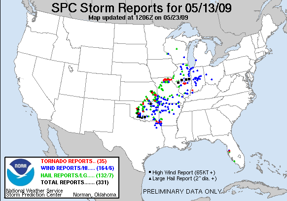
| Conclusion: Well, I got my first tornado of 2009 and my first Missouri tornado. It was a brief, weak, rope tornado, but it definitely counted. Unfortunately, the storm produced a deadly and damaging tornado earlier with fatalities reported in Kirksville. This cyclical supercell was the storm of the day, with the majority of the tornado reports coming in from it. Touchdowns were also reports in Kansas and Oklahoma with a myriad of hail and wind reports across the region as the storms congealed into a severe squall. The first field test of the robotic camera dome seemed to go remarkably well. I was able to stream stills from it live on the internet. The acrylic dome stayed watertight, as well, as we punched through the core of a storm and emerged with all the electronics still working. It wasn't until the next day, however, that I learned that a glitch caused the camera to stop recording to its hard drive an hour into the chase. I had none of the footage from our tornado. I was heart broken, but between my stills and Ben's HD video of the tornado, we hadn't really lost anything except our view while fleeing the storm.
|
|
|
|
|
|
Lessons Learned:
|
|
|
|
|