
Statistics:
| Initial Target: | WaKeeney, KS |
| Departure: | Leawood, KS 10:00 am |
| Arrival: | Norton, KS 8:15 pm |
| Intercepts: | Dighton, KS |
| Tornadoes: | 4 |
| Hail: | Severe (1.00 inch/Quarter Sized) |
| Wind: | Non-Severe (not measured) |
| Features: | Tornado, Wall Cloud, RFB |
| Miles: | 526 |
Summary:
| Exceptionally deep surface low for May and stalled trough created first day of several good chase days in Plains. Left Leawood KS in the morning with Chad Cowan and Nick Lockwood heading for the dryline near WaKeeney. Storms initiated enroute and we headed southwest to pick up the tail end storm near Garden City. Intercepted east of Garden City noting wall cloud. Pursued storm near Dighton spotting two brief tornadic circulations on the ground with rotation aloft, and a shaggy bowl shaped lowering with ground circulations underneath. Struggled to keep up with fast moving HP and called it a chase near WaKeeney, and headed to Norton for dinner and lodging. |
Crew and Equipment:
| Chase team included Chad Cowan and Nick Lockwood. Equipment: TH-F6A Tribander, and GPS/Cell Phone equipped laptop. Photography by Skip Talbot. |
Details:
| After weeks of watching the models, it finally came together for a memorial day weekend supercell fest. An exceptionally deep surface low (980's) and upper level trough was forecast to stall over the western plains providing great shear along an unstable dryline for several days. |
 |
||
| I left straight from work on Wednesday night for
Nick's folks' place in Edwardsville, picked him up and we headed for Chad's
folks' place just outside of Kansas City. After a few hours of sleep
interrupted by excitement over tomorrow's setup, we prepped the van and were
off at 10 am, heading for the dryline on I-70 towards WaKeeney. A
popular target was the warm front where low level shear would be better, but
we were worried that storms would quickly cross into stable air and wanted
to play something a little more discrete to the south.
|
|||
| Cells went up early at our targeted area and continued to fire down the dryline to the south. We broke off I-70 and headed southwest towards Great Bend to pick up the southern most cell as the other cells would be well north of 70 by the time we got there. | |||
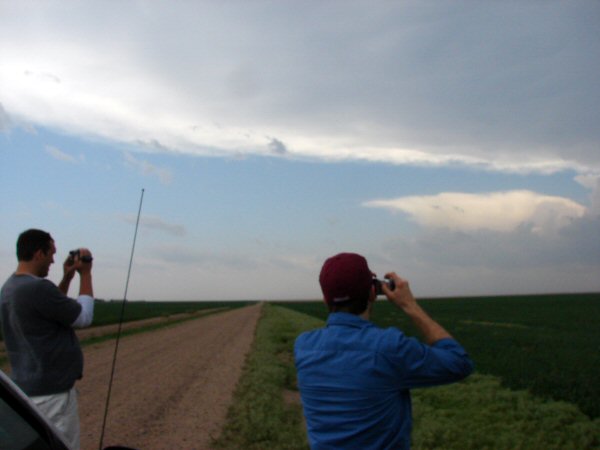
| We caught the updraft base of our supercell just east of Garden City and pulled over for some pictures. Chad and Nick shooting the storm with the anvil overhead: |
 |
||
| Rain free base (RFB) with a ragged wall cloud trying to organize and a sharp rain foot: |
 |
||
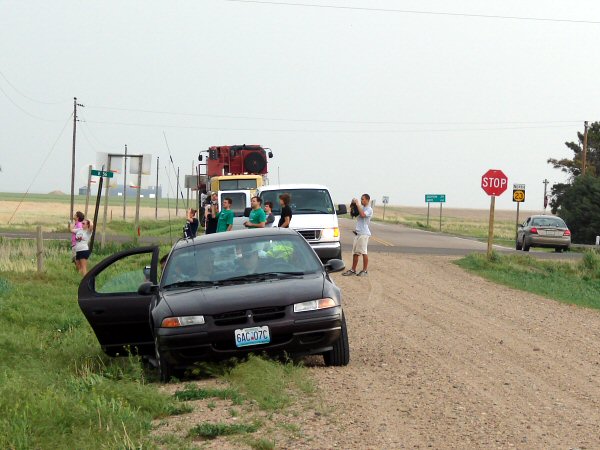
| One thing you can expect with big setups on Memorial Day weekend are hordes and hordes of chasers. Chasers and chase tour groups starting to congregate: |
 |
||
| The wall cloud bulking up a little as it approached from the southwest: |
 |
||
| Nick watching the storm with mammatus overhead: |
 |
||
| The wall cloud never had much going for it. At one point it produced a funnel look-a-like condensation underneath: |
 |
||
| Storms were moving at a good clip north-northeast and we had to get back on the road to keep up with them. Between Garden City and Dighton we saw some interesting patterns in the precipitation shafts. |
 |
||
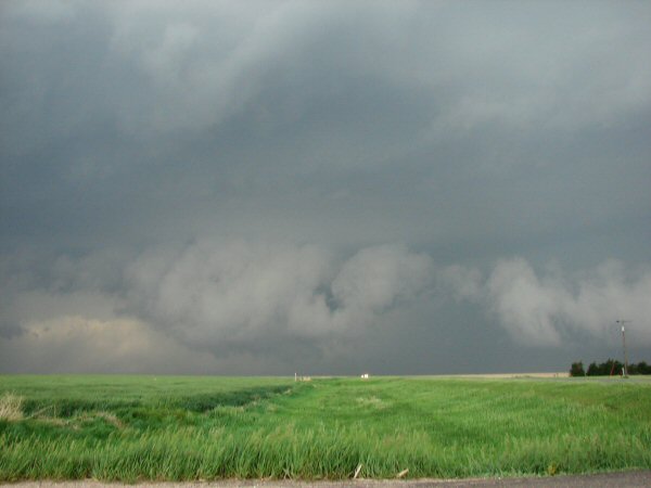
| We got out ahead of the storm and pulled off for some more pictures just outside of Dighton. A massive yet ragged wall cloud was fanning out from the updraft base and heading right for us. |
 |
||
| Rear gust front of the storm, although we had strong inflow winds during this time: |
 |
||
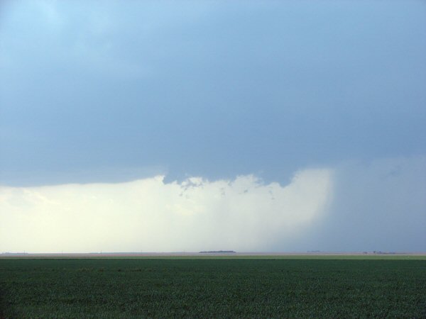
| Dust started to kick up to our south. Rear flanking downdraft (RFD)? Gustnado? Rotating needle funnels in the cloud base told otherwise. We had a weak tornado underway. |
 |
||
| We watched a couple dust whirls kick up under needle funnels as part of a larger area of rotation aloft. |
 |
||
| I had Chad and Nick pose for a picture as we informed an unconvinced Nick that he was watching his first tornado. |
 |
||
| After the dust whirls subsided the wall cloud fanned out overhead like the storm was starting to gust out. We got hit by the RFD and a wall of dust. The winds were intense and really got our hearts going, but they were non tornadic. |
 |
||
| We started moving north again to get closer to the updraft base. Looking east from behind the gust front at a ragged lowering: |
 |
||
| Here's a tornado look-a-like precipitation shaft we spotted: |
 |
||
| As we got closer to the updraft base we saw a huge RFD clear slot cut out of the storm: |
 |
||
| We drove right under the clear slot and looked straight up into the heart of the storm. Towering cumulus stretched thousands of feet overhead with the back edge curling around on itself. It was quite the sight. |
 |
||
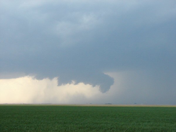
| There was new development still to our north and we raced to try and keep up with it. This shaggy lowering had ground circulation underneath it, and although we weren't sure at the time, several other chasers confirmed this as a tornado. |
 |
||
| We got some good foreground contrast as a nice wall cloud condensed and the outflow kicked up massive amounts of dirt ahead of the storm: |
 |
||
| Also visually stunning was a brilliant white hail shaft visible between the updraft base and the dark rain core to our north. |
 |
||
| Another dust cloud kicked up to our northeast as we drove north. This one had a more laminar appearance like that of a landspout. |
 |
||
| A condensation funnel condensed briefly and extended almost half way to the ground. Contrast enhanced: |
 |
||
| We snagged a picture of our fourth tornado of the day a few minutes later, although we had no idea at the time we had captured a highly embedded stovepipe shape tornado. |
 |
||
| Extreme contrast enhance shows the condensation funnel: |
 |
||
| The storm continued to pull ahead but for a moment we got a high contrast view of the now gigantic wall cloud. |
 |
||
| The storm turned into an HP beast as we got on 70 and went east to WaKeeney for a north option to keep up with it. However, the cells started to deteriorate as a squall line encroached from the west. |
 |
||
| We called it a chase and tried to get dinner in Hill City, but the Pizza Hut staff was in the process of closing the restaurant because of the storm threat (even though it had since ended by then). We got our steak dinner in Norton and hunkered down there for the night. We caught three tornadoes, although they were weak and lacking the coveted photogenic condensation funnel. It was still a great first day for the chase trip. | |||
| Conclusion: Well we missed the best tornadoes, which is a bit disappointing but we still had a good run. Nick saw his first tornado even though it was at the bottom of the scale. The muddy Kansas roads and fast, north motions made the chase rather difficult as would be the case the next day as well. Had we targeted storms closer to the warm front we may have seen a bit more tube action, and we should have also stayed closer to the updraft bases instead of falling back on the gust front.
|
|||
|
|
|||
Radar Analysis with GPS Overlay:
|
|||
|
Lessons Learned:
|
|||
|
|
|||

